The Middle and Lower Yangtze Valley Plain
lies along the middle and lower reaches of Yangtze River, east of Yichang city,
Hubei province. It has an area of about 200,000 square km and is the third largest
plain in China.
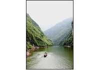
The natural system of Yangtze River, together with crisscrossed man-made rivers
and canals, makes this region one of the most densely distributed river networks
in China. This is also the area where most of China freshwater lakes are concentrated.
The famous freshwater lakes include Poyang Lake, Dongting Lake, Taihu Lake, Hongze
Lake, Chaohu Lake and so on. The lake and swamp areas abound in aquatic creatures.
So this region has the most widely distributed and the largest production of aquatic
plants. Its production of freshwater animals also ranks first in the country.
This region is Chinese producer of grain, oil and cotton. There are boundless paddy-fields
yielding large amounts of paddy. Freshwater fishery is also well developed here.
It is a famous land of fish and rice in China.
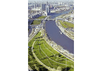
The Middle and Lower Yangtze Valley Plain has a large population and densely distributed
cities. It also has a very convenient transportation system and a prosperous economy.
Important cities like Wuhan, Changsha, Nanjing and Shanghai are located here.
Previous Next